

BALATAN HANDA!
BALATAN HOTLINE: 0915-777-1234 | 0989-111-1234 | 054-8113434 | FB: Balatan Rescue

Balatan is highly vulnerable to the impacts of climate change, including increased temperatures, reduced rainfall, a greater number of hot days, and more frequent extreme rainfall events. This susceptibility is heightened by the area’s exposure to natural hazards such as landslides, floods, and droughts, as well as its dependence on climate-sensitive resources. Shifts in rainfall patterns and temperature directly affect the municipality and pose significant risks to vital services and industries, including forestry, energy, agriculture, mining, tourism, biodiversity, and other resource-based livelihoods.
The increased risks of landslides, flooding, and drought resulting from climate change threaten not only Balatan’s natural ecosystems but also its economy and the well-being of its residents. As these hazards intensify, essential services and industries are likely to face greater challenges, potentially disrupting resource availability and straining local infrastructure and emergency response systems. Proactive adaptation measures are essential to safeguard the municipality’s resources, support sustainable livelihoods, and build resilience against future climate impacts.
The two major hazards that the municipality has to deal with are flooding and landslides.
Flood And Landslide Exposure
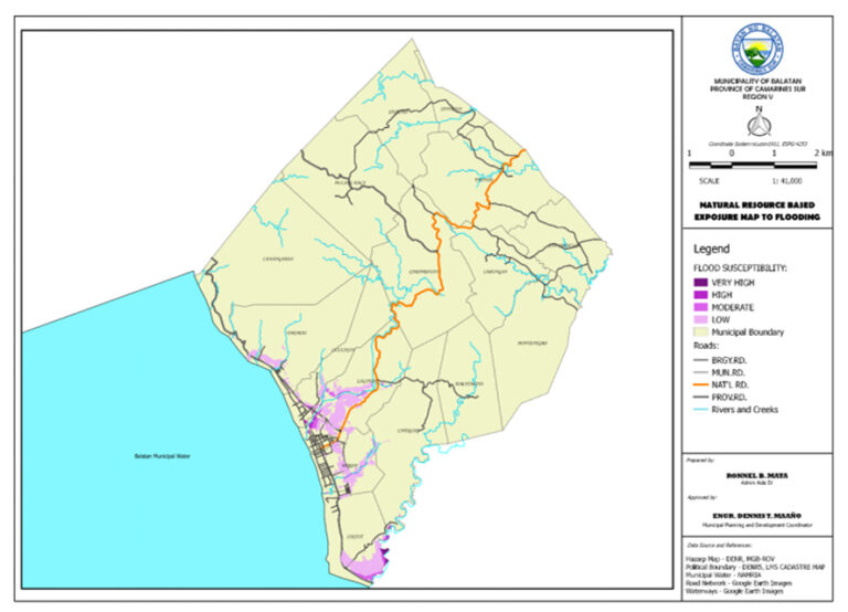
Flooding typically occurs due to intense rainfall, overwhelming natural watercourses such as rivers and creeks, which are unable to handle the excess water. The most severely affected barangays include Coguit, Duran, Laganac, Lulucan, Pararao, and Siramag, where susceptibility to flood risks is high and increasing. Additionally, Barangay Camangahan experiences flooding when rainfall exceeds 180 mm in a single day, with a sudden onset and moderate to low susceptibility. Due to their unpredictable nature and short duration, floods pose a significant threat to these areas.

Population exposure
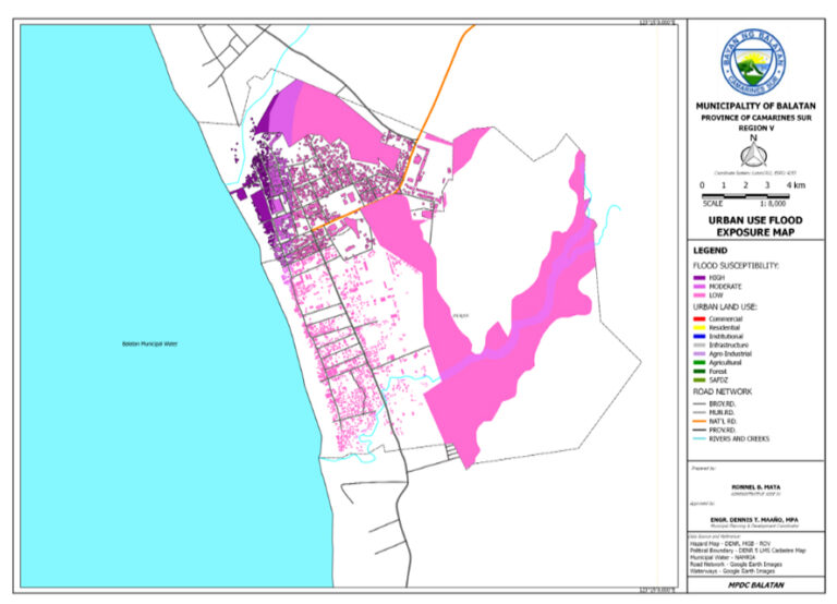
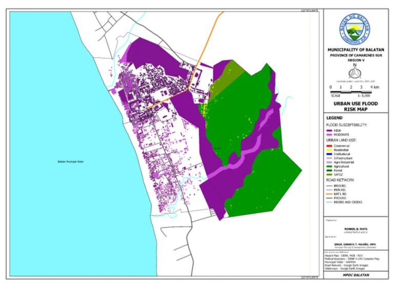
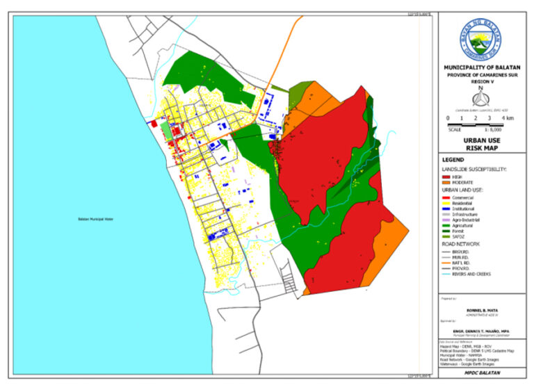
Urban use areas exposure

Natural resource-based porduction areas exposure

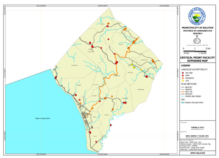
Critical point facilities exposure

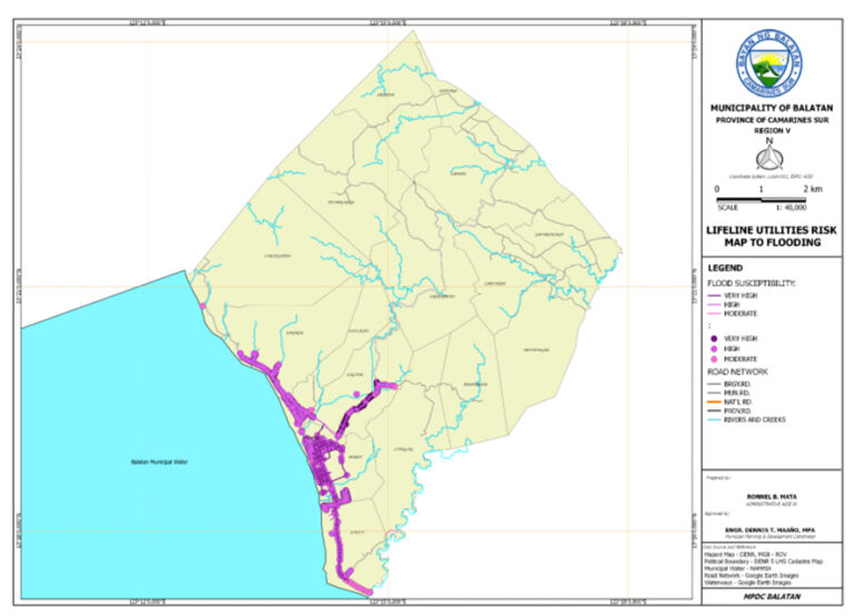
Lifeline utilities exposure
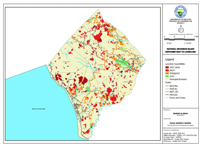
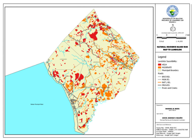
Balatan’s exposure to landslide
Landslide hazards are exacerbated by the steep slopes of Balatan’s hilly terrain, combined with weathered soils and heavy rainfall, creating serious slope stability concerns. Barangays such as Cabannaban, Cabungan, Cayogcog, Laganac, Pulang Daga, and Tomatarayo are particularly prone to rain-induced landslides, with a sudden onset and high vulnerability. Barangays with high susceptibility to these landslides also include Camangahan, Coguit, Duran, Luluasan, Montenegro, Pararao, Sagrada, San Francisco, Santiago, and Tapayas. These barangays are highly vulnerable to landslide events, especially during periods of intense rainfall
Population exposure

Urban use areas exposure
Natural resource-based porduction areas exposure
Critical point facilities exposure

Lifeline utilities exposure
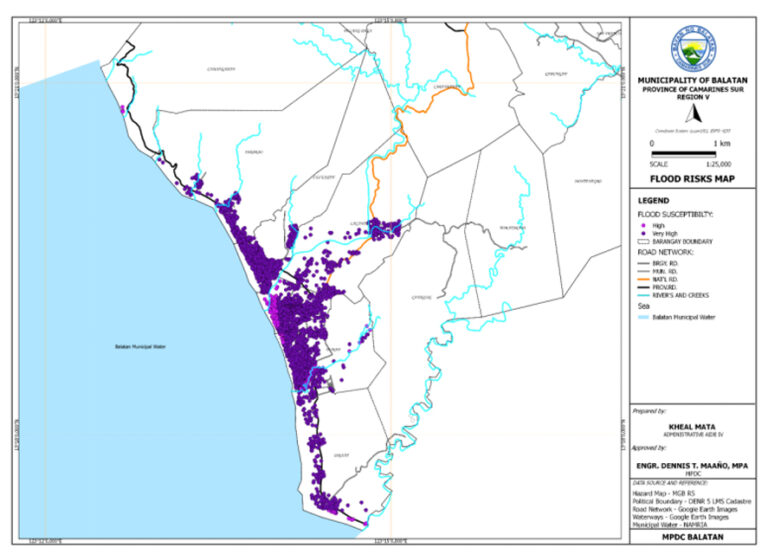
Balatan’s risk to flood
The municipality of Balatan faces significant flood risks across multiple sectors, impacting residents, urban areas, natural resources, critical facilities, and essential infrastructure. Barangays Coguit, Duran, Luluasan, and Siramag have very high flood risks, affecting thousands due to their high exposure and limited protective measures, while Laganac and Pararao are also at high risk. Urban land use areas in Siramag and several zones in Duran are highly vulnerable, and most agricultural areas face moderate flood risk, with Duran and Laganac’s vegetable and corn production areas particularly exposed.
Population risk
Urban use areas risk
Natural resource-based porduction areas risk

Critical point facilities risk
Lifeline utilities risk
Balatan’s risk to landslide
Balatan faces significant landslide risks across its population, land use areas, natural resources, critical facilities, and infrastructure. Barangays like Cabanbanan, Cabungan, Cayogcog, Laganac, Pulang Daga, and Tomatarayo are particularly vulnerable due to steep terrains, with additional barangays like Camangahan, Coguit, and Lulahasan at high risk from environmental and demographic factors. High-risk zones include agricultural and natural resource production areas, especially in barangays such as Camangahan and Pararao.

Population risk
Urban use areas risk
Natural resource-based porduction areas risk

Critical point facilities risk

Lifeline utilities risk


BALATAN TOTAL POPULATION: 30,669
TOTAL NUMBER OF HOUSEHOLD: 6,464
TOTAL NUMBER OF BARANGAYS: 17
| Hazards | Affected bgys. | Low risk - no. of individuals | Medium risk - no if individuals | High risk - no. of individuals | Total affected |
|---|---|---|---|---|---|
| Flood | 7 | 19,586 | |||
| Landslide | 16 | 22,885 | |||
| Typhoon | |||||
| Tsunami | |||||
| Storm surge | |||||
| Earthquake |

NDRRM
National Disaster Risk Reduction and Management Council

PAGASA
Philippine Atmospheric, Geophysical and Astronomical Services Administration

DENR
Department of Environment and Natural Resources

DOST
Department of Science and Technology

UNDRR
UN Office for Disaster Risk Reduction

IPCC
Intergovernmental Panel on Climate Change

UNDP
United Nations Development Programme

The World Bank / CCKP
World Bank Climate Change Knowledge Portal

ADPC
Asian Disaster Preparedness Center

EOS
Earth Observatory of Singapore

UPRI
University of the Philippines Resilience Institute

RCCC
Red Cross and Red Crescent Climate Centre

Oxfam International

Plan International

PreventionWeb

ReliefWeb


This website forms part of the project “Strengthened Resilience to the Effects of Climate Change of the Disaster-Affected Population in Balatan, Camarines Sur, Philippines,” an initiative aimed at enhancing community resilience, disaster preparedness, and climate change adaptation at the local level. The project is implemented through a collaborative partnership between the Local Government Unit of Balatan, Fundación Religiosos para la Salud (FRS), and Siervas de Jesús de la Caridad (SJC), with funding support from the Generalitat Valenciana (GV).
As part of the project, this website serves as a central platform for early warning information, disaster preparedness guidance, and risk awareness, supporting efforts to reduce the vulnerability of communities to climate-related and disaster hazards. It provides accessible and up-to-date information on early warning systems (EWS), preparedness measures, response protocols, and other risk reduction resources, contributing to informed decision-making and increased community readiness.Through this partnership, the project promotes inclusive, sustainable, and community-driven approaches to disaster risk reduction and climate resilience in Balatan.